
Utility Site Mapping
U.L.L.S. Inc. uses both robotic total stations and survey grade GPS equipment to map the locations of buried utility assets. In addition, U.L.L.S. Inc. provide state of the art hosted mapping software for our customers to use so they may use the data today, tomorrow, and in the future without the fear of losing critical data.
CAD Documentation
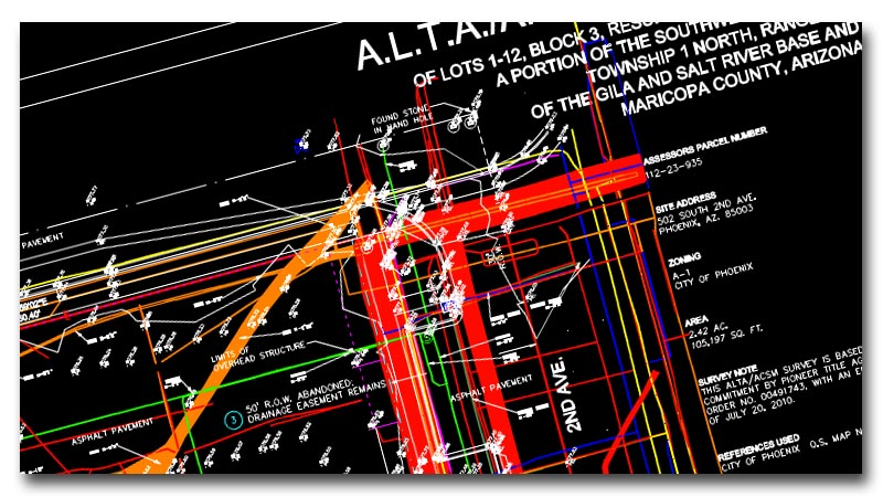
At U.L.L.S. Inc. we understand how important it is to have have accurate documentation provided, not only to the customer but to any Architectural or Engineering firm they are using. We therefore offer the customer the option of having their mapped utility information provided in CAD or overlayed onto their existing CAD drawings.
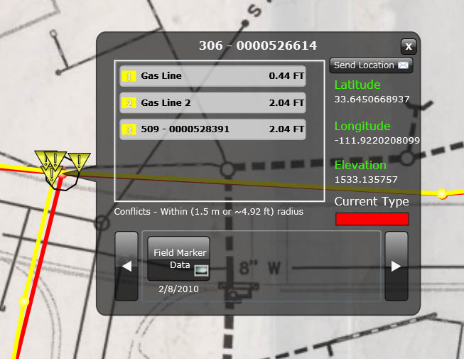
Know Your Utility Conflicts Before It's Too Late
As an added value we can also provide our proprietary mapping system to the customer which can not only display your mapped information in usefull format but will also warn you of potential conflicts with utilities.